
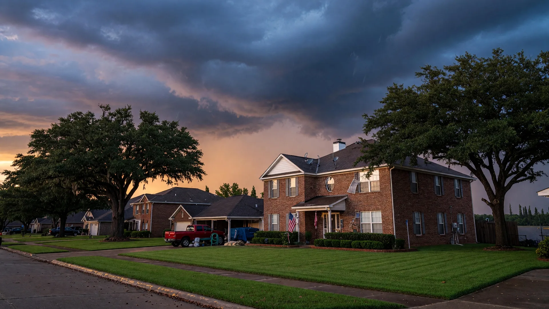
Hurricane season runs from June 1 through November 30, and if you live anywhere in Greater Houston, you already know this isn't an abstract threat. The Houston metro sprawls across a flat coastal plain crisscrossed by bayous, rivers, and drainage channels that can swell quickly when tropical moisture moves inland. From the San Jacinto River corridor in the northeast to the Buffalo Bayou basin in the city center, from the Katy prairies in the west to Galveston County's coastline in the southeast, every corner of this region has its own flood history and risk profile. Kingwood, Humble, Porter, and Atascocita sit along the West and East Forks of the San Jacinto River and Lake Houston. Katy and Cypress drain into Buffalo Bayou and Bear Creek. Bellaire, Meyerland, and Memorial are defined by their relationship with Buffalo Bayou and Brays Bayou. Clear Lake and Galveston County face both bayou flooding and coastal surge. Many of us lived through Harvey in 2017, when 30 to 40 inches of rain overwhelmed systems across the entire metro. Tropical Storm Imelda hit the northeast side hard in 2019. The May 2024 flooding event was another reminder that Houston's storm risk is not confined to any single neighborhood or watershed. Whether you bought your home after the storms or you've been here for decades, the annual rhythm of hurricane preparedness is part of life in Greater Houston. Here's a practical, no-panic guide to getting your home and finances ready before the next named storm, written for homeowners across the entire Houston metro.
What's Changed Since Harvey
Greater Houston is meaningfully better protected than it was in 2017, though the improvements are uneven across the metro. Harris County's $2.5 billion flood bond program, approved in 2018, has funded projects in nearly every watershed. On the northeast side, Kingwood recently received approval for a $56.9 million project to improve Taylor Gully channel conveyance and construct the Woodridge Stormwater Detention Basin, which directly benefits homeowners in northeast Kingwood where the Taylor Gully corridor was one of the hardest-hit drainage channels during Harvey. Flood gates on the Lake Houston Dam are being improved with $100 million in state and federal funding, affecting water levels in Kingwood, Humble, and Atascocita. Dredging along the West and East Forks of the San Jacinto River has removed hundreds of thousands of cubic yards of silt that worsened flooding near Humble and Porter. Downtown and Inner Loop, meanwhile, have benefited from improvements to Buffalo Bayou and Brays Bayou, including expanded detention basins and channel widening projects. On the west side, the Harris County Flood Control District has worked on Barker Reservoir and Addicks Reservoir operations, which affect neighborhoods from Energy Corridor to Katy. In southeast Houston and Galveston County, coastal resilience projects and beach nourishment programs are adding another layer of protection against storm surge.
These are real, physical improvements that reduce flood risk across the region. But no amount of infrastructure eliminates the reality that Houston sits on a flood-prone coastal plain, and every homeowner still needs to be personally prepared. After Imelda in 2019 and the May 2024 flooding events, we were reminded that the San Jacinto River system, Buffalo Bayou, and dozens of other bayous can overwhelm even improved infrastructure when rain falls fast enough. Infrastructure reduces risk; preparation reduces impact.
Your Insurance Review: The Most Important Hour You'll Spend This Summer
If you do one thing from this list, do this: review your homeowners insurance policy before the peak of storm season. Not after a storm is approaching. Now, while you have time to make changes without urgency. Here's what to look at:
- Dwelling coverage vs. replacement cost. Your dwelling coverage should reflect what it would cost to rebuild your home today, not what you paid for it. Building materials and labor costs have risen significantly since 2020. If your coverage is based on a purchase price from three or four years ago, it may be short.
- Flood insurance. Standard homeowners policies do not cover flood damage. If you're in or near a FEMA high-risk flood zone (Zone AE), flood insurance is mandatory with a federally backed mortgage. Even if you're in Zone X, consider a preferred risk policy. After Harvey, many homeowners across the Houston metro who were officially outside the floodplain experienced water intrusion when bayous and rivers overtopped their banks in unexpected areas. During Imelda in 2019, homes in Kingwood, Humble, and other northeast Houston neighborhoods that had never flooded before took on water. In Bellaire and Meyerland, repeated flooding along Brays and Buffalo Bayou has made flood insurance a practical necessity even for homes technically outside Zone AE. Flood insurance for Zone X properties across much of the Houston metro can cost as little as $400 to $600 per year, a fraction of the cost of even a minor flood event.
- Wind and hail deductible. In Texas, many policies carry a separate wind and hail deductible, often expressed as a percentage of dwelling coverage rather than a flat dollar amount. On a $400,000 dwelling coverage policy with a 2% wind/hail deductible, you'd be responsible for the first $8,000 of wind or hail damage before insurance kicks in. Know your number.
- Additional living expenses (ALE). If your home becomes uninhabitable after a storm, ALE covers temporary housing. Check the limit and duration. After Harvey, this coverage was a lifeline for families across the Houston metro, from Kingwood to Bellaire to Dickinson, who spent weeks or months in temporary housing while repairs were completed.
Insurance premiums are a significant part of your monthly housing cost across Greater Houston, especially for homes near water or in flood zones. Flood insurance rates vary widely depending on your zone, elevation, and distance from water, but even Zone X properties throughout the metro can benefit from a preferred risk policy. If you're evaluating whether you can truly afford a home in the Houston area, factoring in Texas property taxes, insurance, HOA fees, and potential flood insurance, my Texas-specific payment calculator gives you the complete monthly picture, not just the mortgage estimate.
The Physical Prep: Your Home's Storm Readiness Checklist
Beyond paperwork, your home itself needs attention. Here's a straightforward checklist to work through before August, when the historically busiest stretch of Atlantic hurricane season begins:
- Roof inspection. Have a licensed roofer inspect your roof, especially if it's more than 10 years old. Look for damaged or missing shingles, deteriorated flashing around vents and chimneys, and any soft spots that indicate water intrusion beneath the surface. A small roof leak becomes a major problem during sustained heavy rain.
- Gutters and drainage. Clean your gutters and downspouts. Extend downspouts at least 4 to 6 feet away from your foundation. Across the Houston metro, where expansive clay soil is common, poor drainage isn't just a flood risk. It can cause foundation movement and structural damage. Homeowners in Humble, Porter, Katy, Cypress, and other rapidly developing areas should pay particular attention to how water flows across their lot during heavy rain, since drainage patterns can vary significantly from one property to the next.
- Trees and limbs. Trim back any dead or overhanging branches within striking distance of your roof or power lines. Mature trees are one of the defining features of Houston's older neighborhoods, from Kingwood (they don't call it The Livable Forest for nothing) to the oak-lined streets of Bellaire, West University, and Memorial. In subdivisions like Cinco Ranch or Bridgeland in Katy, the newer landscaping may look sturdy, but young trees planted within the last five years often have shallow root systems and are more likely to topple in sustained winds. This is especially important for homes backing to greenspaces, wooded lots, or community trails.
- Garage door reinforcement. Your garage door is often the largest and weakest point on your home's wind envelope. If your door isn't rated for wind pressure, consider a reinforcement kit or upgrade. A breach in the garage door can pressurize your home's interior and dramatically increase roof uplift.
- Outdoor items. Secure or store patio furniture, grills, planters, trampolines, and anything that could become airborne. This sounds basic, but loose outdoor items cause a surprising amount of damage during tropical storms that never reach hurricane strength.
- Know your flood history. If you're not sure whether your property flooded during Harvey or other events, check with your neighbors, review the seller's disclosure if you purchased after 2017, and look up your address on the Harris County Flood Education Mapping Tool. In Kingwood, some streets flooded during Harvey even though they were technically outside the mapped floodplain. In Porter, entire subdivisions saw water where no one expected it. Bellaire and Meyerland homeowners have seen repeated flooding along Brays Bayou over multiple storms. Knowledge about your specific lot's history is one of the most valuable things you can have, regardless of where in the Houston metro you live.
Your Financial Storm Kit
Physical preparation protects your property; financial preparation protects your household. Here's what to have in order:
- Emergency fund. Even with insurance, there will be deductibles, immediate expenses (hotel, food, clothing), and costs that may not be fully covered. A minimum of $2,000 to $5,000 in accessible savings, separate from your regular budget, is a reasonable baseline for hurricane preparedness.
- Document your home. Walk through every room with your phone and photograph or video everything, including appliances, fixtures, contents, and the condition of walls and ceilings. Store these files in cloud storage, not just on your phone. If you need to file a claim, documentation is everything.
- Insurance agent contact info. Have your agent's direct phone number saved, not just the 1-800 claims line. After a major storm, the main lines get overwhelmed. A local agent who knows you can move faster.
- Net proceeds awareness. If you're thinking about selling in the near term and wondering what you'd actually walk away with after your mortgage, fees, and any storm-related costs, my Net Proceeds Estimator gives you a clear picture of your real numbers.
Across Greater Houston: Area-Specific Considerations
Not every Houston neighborhood faces the same risk profile. Flood exposure depends on which watershed you're in, your elevation relative to nearby bayous or rivers, and how quickly development upstream is outpacing drainage infrastructure. Here's what to know based on where you are:
- Kingwood (The Livable Forest): The most established community in the Greater Houston corridor, with significant infrastructure investment post-Harvey. Kingwood's flood exposure is shaped by three factors: proximity to the San Jacinto River, the Taylor Gully drainage channel, and Lake Houston itself. Homes near the river, along the Greenbelt, or in neighborhoods like Forest Cove and Kings Point face higher flood exposure. During Harvey, Kingwood was one of the hardest-hit communities in the entire Houston metro, and Kingwood High School sustained an estimated $75 million in damage. The new Taylor Gully detention project and Woodridge Stormwater Detention Basin will help, and Lake Houston Dam flood gate upgrades are adding layers of protection that didn't exist in 2017. But anyone near a waterway should maintain flood insurance regardless of zone designation.
- Humble and Atascocita: Humble's flood risk is shaped by its position along the West Fork of the San Jacinto River and Cypress Creek. Newer developments in the FM 1960 corridor have modern drainage infrastructure, but older neighborhoods closer to the historic Humble downtown area may have aging systems. The West Fork San Jacinto River gauge near Humble triggers major flooding at 52.3 feet, a level it approached during Harvey and Imelda. Atascocita sits on generally higher-elevation terrain relative to other Greater Houston communities, but pockets near Lake Houston and the river system carry flood risk. Homeowners near the lake should pay special attention to wind damage preparedness given the open-water exposure.
- Porter and New Caney: Rapidly growing areas along the East Fork of the San Jacinto River with a mix of new construction and older homes. The river gauge near Porter triggers major flooding at 81 to 92 feet. Many newer communities were built with modern stormwater management, but the sheer pace of development can outpace drainage infrastructure. Sand mine operations along the West Fork near Porter have historically exacerbated flooding when dikes breach. If you're buying new construction in this corridor, ask the builder specifically about the community's stormwater detention design and how it handles a 100-year rain event.
- Katy and Cypress: The rapidly growing west and northwest corridors of the Houston metro sit in the Addicks and Barker Reservoir floodplain. After Harvey, thousands of homes in neighborhoods like Cinco Ranch, Cross Creek Ranch, and Bridgeland experienced flooding when the Army Corps of Engineers released water from the reservoirs to prevent dam failure. Newer master-planned communities in the area have improved detention and drainage design, but the legacy of Harvey means buyers should carefully review flood zone maps and ask about a property's specific experience during that storm. Harris County has invested heavily in channel improvements along Bear Creek and South Mayde Creek, which directly serve the Cypress and Katy area.
- Bellaire, Meyerland, and West University Place: These established Inner Loop neighborhoods sit along Buffalo Bayou and Brays Bayou, two of Houston's primary drainage arteries. Repeated flooding along Brays Bayou, particularly during Harvey and the Tax Day flood of 2016, has made flood awareness a way of life here. Harris County's Brays Bayou Flood Risk Management project has widened and deepened the channel in key areas, and new detention basins upstream are reducing peak flows. Homeowners in these areas should pay close attention to their foundation drainage, especially for slab-on-grade homes where water intrusion can go unnoticed beneath the surface.
- Memorial, Energy Corridor, and Spring Branch: The Memorial area sits between Buffalo Barker and Addicks reservoirs and along Buffalo Bayou, making it historically vulnerable to both bayou flooding and reservoir releases. The Energy Corridor and Spring Branch have seen significant drainage improvements since Harvey, but the area's relationship with Buffalo Bayou means flood insurance remains important. Older ranch-style homes in Spring Branch, many of which were built before modern floodplain mapping, may carry risk that isn't reflected on current FEMA maps.
- Clear Lake, League City, and Galveston County: Southeast Houston communities along the coast face a dual threat: bayou flooding from inland rainfall and storm surge from the Gulf of Mexico. NASA Road 1, the Clear Lake waterfront, and neighborhoods in League City and Dickinson have experienced flooding from both sources. Galveston County's seawall and beach nourishment projects provide coastal protection, but inland neighborhoods in La Marque, Texas City, and Hitchcock are more dependent on drainage infrastructure and channel capacity. If you own property in these areas, your insurance review should account for both wind and flood exposure.
- Northeast Houston and Channelview: The areas east of downtown along the Houston Ship Channel, including Channelview, Cloverleaf, and the East Houston neighborhoods, have a mix of residential and industrial land uses. Drainage infrastructure here varies widely. Proximity to the San Jacinto River and the Ship Channel means both river flooding and storm surge are potential risks. This area saw significant flooding during Harvey and remains underserved by new infrastructure investment compared to other parts of the metro.
When a Storm Is Actually Approaching
When a named storm is projected to impact the Houston area, your priorities narrow to three things: protect, document, and evacuate if advised. The specifics depend on where you are in the metro, but the timeline applies everywhere:
- 72 hours out: Fill your car's gas tank. Withdraw cash. Confirm insurance documents and home documentation are backed up to the cloud. Bring in outdoor furniture and loose items. If you're in a flood-prone area, move valuables and electronics to the highest point in your home. That applies whether you're near the San Jacinto River in Kingwood, along Brays Bayou in Bellaire, or in a low-lying section of Katy near Barker Reservoir.
- 48 hours out: Prepare an emergency kit: water (1 gallon per person per day for at least 3 days), non-perishable food, medications, flashlight, batteries, phone chargers, important documents in a waterproof bag. Fill bathtubs with water for flushing toilets if water service is interrupted. Know your evacuation route. For northeast Houston residents, primary evacuation routes run along FM 1960 and US-59. West Houston residents may use I-10 or Westheimer, while Galveston County residents typically follow I-45 or FM 646. Traffic on any of these corridors can gridlock quickly once evacuations are ordered.
- 24 hours out: If evacuation is recommended for your area, leave. Follow the Harris County Office of Homeland Security and Emergency Management guidance. Do not wait for a mandatory order to make a smart decision. Residents along the San Jacinto River corridors in Kingwood, Humble, and Porter have historically been among the first placed under voluntary or mandatory evacuation orders, as have Galveston County coastal residents. If you're staying, park cars facing outward, turn refrigerators to coldest settings (food lasts longer during power outages), and move to interior rooms away from windows during the storm.
Selling After a Storm: What Sellers Should Know
If you're considering selling your home, whether storm season is a factor in your decision or not, buyers across Greater Houston are more flood-aware and insurance-conscious than ever. They'll ask about your flood zone, your insurance costs, your home's storm history, and the condition of your roof. In Kingwood, buyers want to know specifically whether your home flooded during Harvey or Imelda, whether it's in the Taylor Gully watershed, and what your annual flood insurance premium runs. In Bellaire and Meyerland, buyers ask about Brays Bayou proximity and repeated flood events. In Katy, they ask about Addicks and Barker reservoir exposure. Being prepared with documentation, clear disclosure, and a well-maintained home puts you in a stronger negotiating position.
If you're trying to figure out whether now is the right time to list, my Seller Prep Kit walks you through the practical steps of getting your home market-ready, from documentation to repairs to staging. And if you want a realistic picture of what your home is worth in today's market, request a free home valuation based on actual comparable sales, not an algorithm.
The Perspective That Matters
I have spent my career helping people prepare for high-stakes moments, not by creating panic, but by creating clarity. The same principle applies here. Hurricane season isn't something to dread; it's something to prepare for. The homeowners who do the work in advance, reviewing insurance, maintaining their property, understanding their flood risk, and building a financial cushion, weather storms with far less disruption than those who wait until the radar turns red.
Greater Houston is a remarkable place to live. The diversity, the energy, the sense of community that emerges in neighborhoods from Kingwood to Katy, from the Heights to Galveston County. People move here for opportunity and stay for the neighbors. Every year, the flood infrastructure gets a little better, preparedness gets a little more widespread, and the community grows stronger. Being prepared doesn't diminish your enjoyment of living here. It deepens your confidence in the decision you've made.
Your Quick-Reference Prep Checklist
Print this, bookmark it, or screenshot it. Run through it once before August and you'll be ahead of most homeowners across the Houston metro:
Hurricane Season Home Prep Checklist
- Review homeowners insurance: dwelling coverage, flood policy, wind/hail deductible, ALE limits
- Professional roof inspection, especially for homes 10+ years old
- Clean gutters and extend downspouts 4 to 6 feet from foundation
- Trim dead or overhanging tree branches near roof and power lines
- Check garage door wind rating; reinforce if needed
- Secure or store all outdoor items
- Verify your flood zone designation on FEMA's mapping tool
- Photograph/video every room for insurance documentation
- Confirm emergency savings of $2,000 to $5,000 accessible
- Prepare emergency kit: water, food, meds, documents, chargers
- Save your insurance agent's direct phone number
If you want to talk through any of this, your flood zone status, your insurance coverage, whether your home is positioned well for the current market, or how to factor storm risk into your long-term housing plan, that's exactly the kind of conversation I'm here for. No pressure, no sales pitch. Just clear, structured guidance so you can make confident decisions.